

01
Scope the location and outcome
We confirm the property, intended use, timing, deliverables, access, site rules, weather window, and any permissions or safety constraints before scheduling capture.
$100 for you + $100 for themReferral program
Refer a company — $100 in account credit for you and $100 for them.Referral program
Loading this page. This should only take a moment.
Photography, video, panoramas, and progress coverage scoped by location, permissions, capture plan, schedule, and deliverables.
Website maintenance in progress · Check back September 1
Website maintenance in progress — Please check back September 1 for the full release.
Loading this page. This should only take a moment.
Photography, video, panoramas, and progress coverage scoped by location, permissions, capture plan, schedule, and deliverables.
Photography, video, panoramas, and progress coverage scoped by location, permissions, capture plan, schedule, and deliverables.
Photography, video, panoramas, and progress coverage scoped by location, permissions, capture plan, schedule, and deliverables.
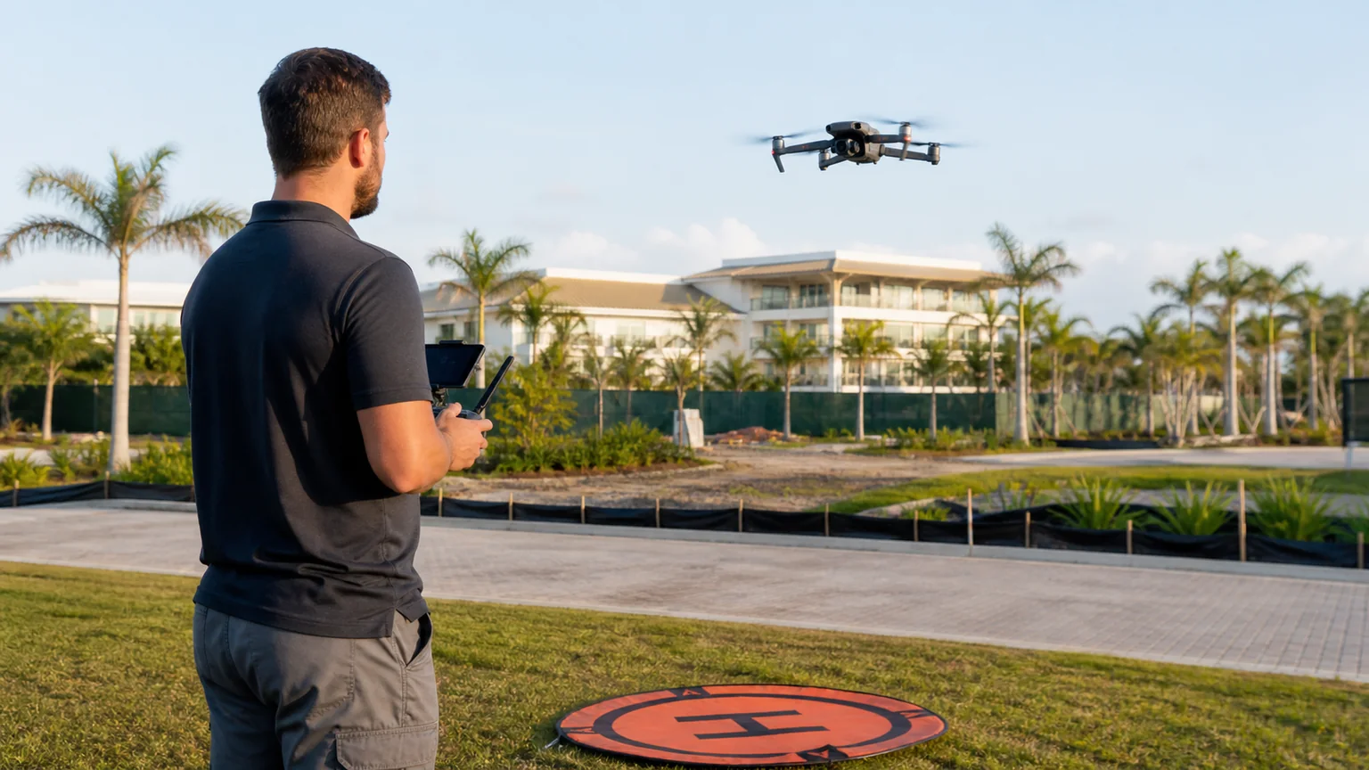
A straightforward path from scope to launch.
We confirm the property, intended use, timing, deliverables, access, site rules, weather window, and any permissions or safety constraints before scheduling capture.
You approve the shot list, recurring cadence where needed, key viewpoints, visual priorities, and the written scope before the work begins.
We complete the approved aerial capture when conditions and site access allow, then organize the media around the agreed dates, viewpoints, and deliverable format.
You receive the agreed photo, video, panorama, or recurring documentation package with a clear review path for anything that needs follow-up.
A straightforward path from scope to launch.
We confirm the property, intended use, timing, deliverables, access, site rules, weather window, and any permissions or safety constraints before scheduling capture.
You approve the shot list, recurring cadence where needed, key viewpoints, visual priorities, and the written scope before the work begins.
We complete the approved aerial capture when conditions and site access allow, then organize the media around the agreed dates, viewpoints, and deliverable format.
You receive the agreed photo, video, panorama, or recurring documentation package with a clear review path for anything that needs follow-up.
Plan a single South Florida capture or a recurring visual record. Deliverables are organized around the decision the imagery needs to support—not around a generic flight package.
Dated, organized imagery that gives off-site stakeholders a clearer view of work and changing site conditions.
Best for: General contractors, developers, builders, owners, municipalities, and project managers
High-resolution RGB imagery of visible exterior conditions and difficult-to-view areas for qualified teams to review.
Property-scale context for operations, records, planning conversations, and polished commercial presentation.
Location-aware imagery that shows the property, amenities, surrounding area, and sense of place in one story.
Motion-led aerial content for South Florida businesses and destinations where the setting is part of the sale.
Repeatable visual records
Planned viewpoints make changing conditions easier to compare across a project timeline.
Choose a one-time visit or weekly, biweekly, or monthly progress coverage. The written plan confirms the location, planned viewpoints, delivery format, and reporting rhythm before the first visit.
Custom-quoted aerial work
Choose a one-time shoot or recurring progress capture. We’ll confirm the location, viewpoints, deliverables, and schedule before the first visit.
Plan aerial coverage
Choose the story you need to tell, then match capture type, access, editing, delivery, and repeat coverage to the property or project.
Answer three quick questions. Nothing is added until you choose.
Plan aerial coverage
Choose the story you need to tell, then match capture type, access, editing, delivery, and repeat coverage to the property or project.
Answer three quick questions. Nothing is added until you choose.
Quick fit guide
0 of 2 answered
2 quick questions to point you to the right option.
Choose the outcome or need first to receive a recommendation.
Choose the first planning step above. The recommendation and pricing explanation will update here—nothing is added to your estimate automatically.
Scope the location and outcome
We confirm the property, intended use, timing, deliverables, access, site rules, weather window, and any permissions or safety constraints before scheduling capture.
Plan the capture
You approve the shot list, recurring cadence where needed, key viewpoints, visual priorities, and the written scope before the work begins.
Capture and organize
We complete the approved aerial capture when conditions and site access allow, then organize the media around the agreed dates, viewpoints, and deliverable format.
Review and deliver
You receive the agreed photo, video, panorama, or recurring documentation package with a clear review path for anything that needs follow-up.
See relevant work before you decide
Review case studies and delivery examples related to Drone Media & Aerial Documentation.
See delivery evidenceStill weighing a detail?
Ask a specific question without losing the service, pricing, or recommendation context you selected above.
Every engagement is custom quoted from the location, access, permissions, travel, capture time, deliverables, editing, recurring cadence, and delivery requirements. You review the written scope before work is scheduled.
Plan a single South Florida capture or a recurring visual record. Deliverables are organized around the decision the imagery needs to support—not around a generic flight package.
Dated, organized imagery that gives off-site stakeholders a clearer view of work and changing site conditions.
Best for: General contractors, developers, builders, owners, municipalities, and project managers
High-resolution RGB imagery of visible exterior conditions and difficult-to-view areas for qualified teams to review.
Property-scale context for operations, records, planning conversations, and polished commercial presentation.
Location-aware imagery that shows the property, amenities, surrounding area, and sense of place in one story.
Motion-led aerial content for South Florida businesses and destinations where the setting is part of the sale.
Repeatable visual records
Planned viewpoints make changing conditions easier to compare across a project timeline.
Choose a one-time visit or weekly, biweekly, or monthly progress coverage. The written plan confirms the location, planned viewpoints, delivery format, and reporting rhythm before the first visit.
Custom-quoted aerial work
Choose a one-time shoot or recurring progress capture. We’ll confirm the location, viewpoints, deliverables, and schedule before the first visit.
Plan aerial coverage
Choose the story you need to tell, then match capture type, access, editing, delivery, and repeat coverage to the property or project.
Answer three quick questions. Nothing is added until you choose.
Plan aerial coverage
Choose the story you need to tell, then match capture type, access, editing, delivery, and repeat coverage to the property or project.
Answer three quick questions. Nothing is added until you choose.
Quick fit guide
0 of 2 answered
2 quick questions to point you to the right option.
Choose the outcome or need first to receive a recommendation.
Choose the first planning step above. The recommendation and pricing explanation will update here—nothing is added to your estimate automatically.
Scope the location and outcome
We confirm the property, intended use, timing, deliverables, access, site rules, weather window, and any permissions or safety constraints before scheduling capture.
Plan the capture
You approve the shot list, recurring cadence where needed, key viewpoints, visual priorities, and the written scope before the work begins.
Capture and organize
We complete the approved aerial capture when conditions and site access allow, then organize the media around the agreed dates, viewpoints, and deliverable format.
Review and deliver
You receive the agreed photo, video, panorama, or recurring documentation package with a clear review path for anything that needs follow-up.
See relevant work before you decide
Review case studies and delivery examples related to Drone Media & Aerial Documentation.
See delivery evidenceStill weighing a detail?
Ask a specific question without losing the service, pricing, or recommendation context you selected above.
Every engagement is custom quoted from the location, access, permissions, travel, capture time, deliverables, editing, recurring cadence, and delivery requirements. You review the written scope before work is scheduled.
Best for: Roofers, restoration companies, property managers, HOAs, solar installers, telecom contractors, owners, and lenders
Best for: Commercial owners, warehouses, industrial operators, dealerships, landowners, developers, and property teams
Best for: Residential and luxury agents, commercial brokers, developers, hotels, resorts, golf courses, HOAs, and multifamily teams
Best for: Yacht brokers, boat dealers, marinas, yacht clubs, waterfront properties, restaurants, venues, and event teams
A defined visit for a listing, inspection-image set, event, milestone, or current-condition record.
Frequent visual progress records for active construction, demolition, restoration, or property work.
A capture every two weeks when stakeholders need a steady record without a weekly visit.
A practical recurring timeline for longer projects, portfolios, communities, and owner updates.
Repeat visits use planned reference viewpoints when conditions allow. Airspace, weather, active equipment, access, and site changes can prevent pixel-identical positioning.
Review two very different aerial applications, then browse examples spanning property records, coastlines, communities, hospitality, and real estate.
Aerial video
A visual record can establish broad site context and preserve visible conditions for the qualified professionals reviewing the property.
Aerial video
Moving aerial footage gives brokers, dealers, marinas, and owners a stronger sense of motion, setting, and scale.
A 360° aerial panorama can turn a wide property or destination into an interactive viewpoint for real estate, communities, developments, hospitality, and location storytelling.
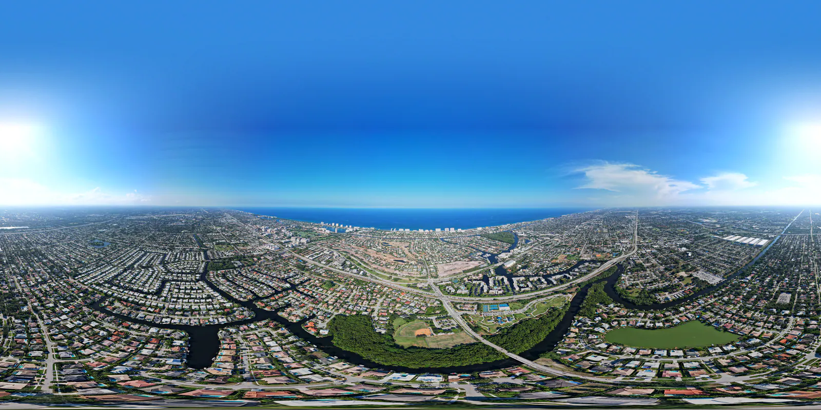
Up to 5.4K video · Up to 20 MP photography · 360° panoramas · Recurring site monitoring · Commercial and property documentation
Final resolution, frame rate, image format, edit, aspect ratio, flight plan, and delivery method are confirmed in the written scope. A lower setting may be used when it better fits low light, file size, playback, airspace, or the requested deliverable.
Written review before scheduling
Every request is reviewed for the site, requested views, airspace, weather, access, safety, permissions, schedule, travel, and intended deliverables before a written quote is issued.
Aerial imagery is visual documentation only. It is not a licensed engineering or building inspection, land survey, appraisal, boundary determination, code-compliance decision, damage-causation opinion, or guarantee that every condition or defect will be visible.
Flight and capture remain subject to applicable airspace authorization, weather, visibility, site access, safe operating conditions, property or event permissions, privacy limits, and any restrictions identified during review. Crowd and event footage is offered only when the planned operation is permitted.
Best for: Roofers, restoration companies, property managers, HOAs, solar installers, telecom contractors, owners, and lenders
Best for: Commercial owners, warehouses, industrial operators, dealerships, landowners, developers, and property teams
Best for: Residential and luxury agents, commercial brokers, developers, hotels, resorts, golf courses, HOAs, and multifamily teams
Best for: Yacht brokers, boat dealers, marinas, yacht clubs, waterfront properties, restaurants, venues, and event teams
A defined visit for a listing, inspection-image set, event, milestone, or current-condition record.
Frequent visual progress records for active construction, demolition, restoration, or property work.
A capture every two weeks when stakeholders need a steady record without a weekly visit.
A practical recurring timeline for longer projects, portfolios, communities, and owner updates.
Repeat visits use planned reference viewpoints when conditions allow. Airspace, weather, active equipment, access, and site changes can prevent pixel-identical positioning.
Review two very different aerial applications, then browse examples spanning property records, coastlines, communities, hospitality, and real estate.
Aerial video
A visual record can establish broad site context and preserve visible conditions for the qualified professionals reviewing the property.
Aerial video
Moving aerial footage gives brokers, dealers, marinas, and owners a stronger sense of motion, setting, and scale.
A 360° aerial panorama can turn a wide property or destination into an interactive viewpoint for real estate, communities, developments, hospitality, and location storytelling.
Up to 5.4K video · Up to 20 MP photography · 360° panoramas · Recurring site monitoring · Commercial and property documentation
Final resolution, frame rate, image format, edit, aspect ratio, flight plan, and delivery method are confirmed in the written scope. A lower setting may be used when it better fits low light, file size, playback, airspace, or the requested deliverable.
Written review before scheduling
Every request is reviewed for the site, requested views, airspace, weather, access, safety, permissions, schedule, travel, and intended deliverables before a written quote is issued.
Aerial imagery is visual documentation only. It is not a licensed engineering or building inspection, land survey, appraisal, boundary determination, code-compliance decision, damage-causation opinion, or guarantee that every condition or defect will be visible.
Flight and capture remain subject to applicable airspace authorization, weather, visibility, site access, safe operating conditions, property or event permissions, privacy limits, and any restrictions identified during review. Crowd and event footage is offered only when the planned operation is permitted.